Adaptive and Interactive Climate Future by Integrating Scientific Information with Local Perceptions
Engila Mishra1*
1Climate Change Specialist, Adaptation for Smallholders in Hilly Areas (ASHA), Nepal.
*Corresponding Author: Engila Mishra, Climate Change Specialist, Adaptation for Smallholders in Hilly Areas (ASHA), Nepal,Tel: 977-9841184089; Fax: 977-9841184089; E-mail:engila.asha@gmail.com
Citation: Engila Mishra (2019) Adaptive and Interactive Climate Future by Integrating Scientific Information with Local Perceptions. SciEnvironm 2: 139.
Copyright: © 2019 Engila Mishra, et al. This is an open-access article distributed under the terms of the Creative Commons Attribution License, which permits unrestricted use, distribution, and reproduction in any medium, provided the original author and source are credited.
Received: July 28, 2019; Accepted: August 06, 2019; Published: August 09, 2019.
Introduction
The Adaptation for Smallholders in Hilly Areas (ASHA) project is being implemented from the Ministry of Forest and Environment (MoFE) and supported by International Fund for Agricultural Development (IFAD). The development objective of ASHA is the following: "vulnerability of local communities to climate related risks reduced and enabling institutional environment for climate change adaptation strengthened". This project has envisaged to achieve this through (i) strengthening the framework for local-level climate adaptation by building adaptive capacity of participating communities and institutions and preparation of enhanced Local Adaptation Plan for Action (LAPA) by integrating information of Geographic Information System (GIS) based sub watershed assessment and participatory scenario development by envisioning scenario of both current and future condition and (ii) improving the resilience of vulnerable people through channeling project and government financing for implementing LAPA priorities at household and community/landscape levels to expand and diversify agricultural and other livelihood options in collaboration with different stakeholders and implementing partners.
Adaptation to the climate change cannot effectively occur unless the planning process adopts an ecosystem based approach. The livelihoods of smallholder farmers depend on natural systems that extend beyond administrative boundaries. Therefore, to enhance the climate resilience of the natural environment and to sustain ecosystem services, the needs of the environment at a larger ecosystem level has been considered in ASHA Project.
This presentation highlights the novel approaches for covering natural system of climate change adaptation plan by adopting the enhanced approaches for Local Adaptation Plan for Action (LAPA) preparation that is integration scientific information with local perceptions. This also contributes to fulfill the gaps identified in existing LAPAs preparation by providing/ suggesting the effective adaptation options and reduction of vulnerabilities of smallholders. These approaches are Geographic Information System (GIS) based sub-watershed and Participatory Scenario Development (PSD). Since, GIS based sub watershed assessment is necessary in order to support for ecosystem level resilience building by addressing upstream and downstream linkages whereas PSD is necessary for envisioning future for balancing both development and ecosystem needs".
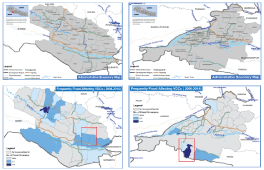
Natural system that has taken in ASHA project is sub-watershed system. Sub-watershed planning is an approach that adopts the boundaries of a sub-watershed for water resource and land use management, acknowledging that ecosystems transcend administrative boundaries. While traditional planning for developing areas are defined by political and administrative borders, and focus largely on human development needs, sub-watershed planning provides an opportunity to balance both development and ecosystem needs, with key consideration given to maintain the form and function of the natural systems. In order to fulfill the gaps identified in existing Local Adaptation Plan for Action (LAPA) from other agencies, ASHA adopts the enhanced approaches for LAPA preparation. Figure 1.
These approaches are Geographic Information System (GIS) based sub-watershed and Participatory Scenario Development (PSD). Since, GIS based sub watershed assessment is necessary in order to support for ecosystem level resilience building by addressing upstream and downstream linkages whereas PSD is necessary for envisioning future for balancing both development and ecosystem needs".
Sub-watershed planning achieves these by recognizing the importance of upstream-downstream linkages in a river basin, realizing that events occurring in the upper stream can have direct influence downstream, and that issues arising downstream can sometimes be prevented or mitigated through the interventions in upstream. For example, agro-chemical discharge upstream can make water downstream unusable, withdrawal of large amounts of water for irrigation in upstream areas can leave less water available for downstream settlements and poor land use and management practices upstream can result in flash flooding and sedimentation downstream.
GIS-based sub-watershed level analysis/ assessment are going on within project districts with the current situation analysis, decadal land use and land cover analysis at sub-watershed level and then identification of vulnerability hotspots such as landslides area, forest fire zones and soil erosion prone area with the upstream and downstream linkages and then recommendation on land adjustment area for climate adaptive interventions.
Similarly, LAPA planning at community level will be enhanced by the application of processes for planning beyond current vulnerability, including Participatory Scenario Development (PSD). PSD methodologies provide a mechanism for communities to explore future development choices and pathways and the impacts of CC and adaptation options within their specific context, to inform investment choices needed to facilitate effective adaptation based on current information and assumptions about future trends. The process will involve establishing a multi-stakeholder forum for assessing the effects of uncertainties and risks on different vulnerable groups and socio- economic sectors, so as to identify a range of response options. Therefore, PSD approach in adaptation planning emphasizes to ensure effective participation of stakeholders, linking qualitative and quantitative information when developing scenarios, and assuring their relevance for adaptation planning and overall decision-making.
How are we integrating this information?
The integration of these scientific information on sub watershed level are downscaling from municipality to ward and settlement with the information collected from local perceptions from settlement to ward and then to rural municipality. Thus, the information at all level validated each other with the both scientific and local perceptions level in order to suggest for the identification and prioritization of effective adaption options.
Then this information is feeding into the LAPA preparation steps from one to three such as on; climate change sensitization, vulnerability and adaptation assessment and prioritization of adaptation options in order to enhance the preparation process. Figure 2.
Conclusion
The adoption of scientific information/analysis done at the sub-watershed level allows these key environmental concerns to be addressed with clear set objectives and targets. This information have been then effectively incorporated into climate change adaptation planning processes for the implementation of environmentally responsive land uses and reduction of vulnerabilities of smallholders. Similarly, PSD approach in adaptation planning emphasizes to ensure effective participation of stakeholders, linking qualitative and quantitative information during scenario development considering both current and future conditions and assuring their relevance for adaptation planning and overall decision-making for resilience building.