Geothermal Energy Potential Estimates of the Niger Delta Basin from Recent Studies
J O Adedapo1*, A E Ikpokonte1, Ewa Kurowska2*, K Schoeneich1
1 Geology Department, Ahmadu Bello University, Zaria, Nigeria.
2 Department of Fundamental Geology, University of Silesia in Katowice, Poland.
*Corresponding Author: Ewa Kurowska, Department of Fundamental Geology, University of Silesia in Katowice, Poland, TEL: (32) 3689 644 ; FAX: (32) 291 5865;E-mail:ewa.kurowska@us.edu.pl
Citation: J O Adedapo, A E Ikpokonte, Ewa Kurowska, K Schoeneich (2018) Geothermal Energy Potential Estimates of the Niger Delta Basin from Recent Studies. SciEnvironm 1:118.
Copyright:© 2018 Ewa Kurowska, J O Adedapo, et al. This is an open-access article distributed under the terms of the Creative Commons Attribution License, which permits unrestricted use, distribution, and reproduction in any medium, provided the original author and source are credited
Received date: June 13, 2018; Accepted date: July 18, 2018; Published date: July 23, 2018.
Abstract
In these work geothermal energy resources maps of the Niger Delta Basin were constructed using borehole thermal log data from over 300 deep wells. Three major geothermal anomalies were delineated and quantitatively interpreted in both onshore and offshore parts of the Niger Delta. The geothermal maps present the distribution of geothermal energy stored in the sedimentary rock mass in two ways: the accessible resources in depth interval 0-4000 m and static geothermal energy resources stored in the complete sedimentary infill of the basin (from ground surface to the basement. The first map shows two major onshore anomalies, one in the north (with maximum energy values, 800 GJ/m2), another in the east to northeastern part (maximum energy values of 1250 – 1500 GJ/m2). Another two major anomalies occur offshore, one in the south with values of 750-1000 GJ/m2, occurring at about 100 km seawards and the other, in the southwest offshore with values 750-1250 GJ/m2, still at about 100 km from the shore. A second map of the Niger Delta shows a small anomaly in the northern part with maximum value of 1500 GJ/m2 and a major anomaly occurring in the eastern part of the basin, onshore, with values of 2000-3500 GJ/m2. Offshore in the south and southwest anomalies in the total sedimentary rock mass occur with highest values up to 4000GJ/m2, with the southwestern anomaly extending west to the shore. It is much of interest to note the seaward – westward extension of these anomalies both in size, configuration and magnitude for the geothermal energy in the total sedimentary thickness to the underlying basement. These anomalous fields show the most favorable locations and areas for further work on geothermal energy resources.
Keywords
Niger Delta Basin, subsurface rock temperature, geothermal gradient, geothermal energy estimates
Introduction
The research area is located on the Atlantic coast of West Africa, between latitudes 3° and 6° N and longitudes 5° and 8° E (Figure 1). The Niger Delta is situated in the Gulf of Guinea in a rift triple junction related to the opening of the southern Atlantic started in the Late Jurassic and lasted until the end of Cretaceous. The Delta began developing in the Eocene, accumulating sediments carried by Niger river that now are over 10 kilometers thick. It is one of the world’s most prolific petroleum producing deltas that accounts for about 5% of the world’s oil and gas reserves and for about 2.5% of the present-day basin areas on Earth [1]. To date, 34.5 billion barrels of recoverable oil and 93.8 trillion cubic feet of recoverable gas have been discovered. Since 1956, when hydrocarbons were discovered there, thousands of deep exploration and exploitation boreholes have been drilled. One of the significant elements of exploration for hydrocarbons is examination of subsurface rocks and fluids temperature, as the process of oil and gas generation is controlled by temperature and depth [2]. Oil windows are often found in the 60-120°C range at 2-4 km depth while significant gas generation occurs between 120°C and 225°C (at a depth of 3-6 km); above 225°C the organic matter is spent and only carbon remains as graphite. Thus, thousands of temperature records and logs in deep (3000 m or more) boreholes were carried out during dozens of years of Niger Delta exploration. Based on these data several attempts to compile comprehensive geothermal reports and maps of the Delta and adjacent areas have been made: Nwachukwu [3], Avbovbo [4,5], Onuoha and Ekine [6], Adedapo et al. [7], Akpabio et al. [8]. These researches presented the results of research on subsurface temperature distribution, geothermal gradients or heat flow determination. The presented study is geothermal energy potential - oriented and show the preliminary estimates of geothermal energy and its distribution within Niger Delta basin.
Geological Setting and Hydrocarbons Occurrence
The origin of Niger Delta is closely linked to the separation of the continental crust of South America and Africa and the formation of the Benue Trough in late Jurassic [9,10]. The separation resulted in the opening of the Atlantic Ocean and this gave rise to the marine incursion which resulted in marine sedimentation in the Lower Benue Trough and the Anambra Basin during the Early Cretaceous. Later on the influx of Niger River clastics from adjacent highlands led to the formation of Niger Delta at the place where the Lower Benue adjoined the Atlantic Ocean [11]. The Niger Delta Basin, together with the Calabar Flank, Anambra Basin, Afikpo Syncline and Abakaliki Anticlinorium make up the Lower Benue Trough (Figure 1).

The geology of southeastern Nigeria has been extensively studied by various researchers among which are Reyment [12], Murat [13], Whiteman [10], Ekwueme et al. [14]. Many years of geological research and exploration led to know many details about geological setting, structure, sedimentology and hydrocarbon generation of Niger Delta basin. Here are some general facts mentioned beneath. The rock formations deposited in the Delta area consists of Cretaceous to Recent sediments. The Paleogene-Neogene sediments are divided into three formations, representing prograding depositional sand-shale facies. They are the marine Akata Formation situated at the base of the Delta. It comprises thick shale sequences (potential source rock), turbidite sand (potential reservoirs) and minor amount of clays and silts. The formation underlies the entire Delta and is typically overpressure. The deposition of the overlying Agbada Formation, the major petroleum-bearing unit, began in the Eocene and continued until the Paleocene (Figure 2). The Agbada Formation consists of paralic silica-clastics over 3700 m thick. In the Lower Agbada Formation, shale and sandstone beds were deposited in equal proportions. However, the upper portion is mostly sand with only minor shale interbeds. The uppermost part of the profile is the Benin Formation, a continental Late Eocene to Recent deposit of alluvial and upper coastal plain sands that are up to 2000 m thick [1].

Figure 2: Lithostratigraphical succession of the Niger Delta sediments (after Jubril et al, 1998).
Materials and Methods
The basic data for evaluation of geothermal energy were the temperature records taken in deep boreholes drilled in the Delta area. Those primary data were obtained from the Department of Petroleum Resources, Lagos - an arm of Nigerian National Petroleum Corporation (NNPC). The company kindly made available temperature information from about 600 boreholes, however not all of them could be used for mapping due to lack of location information. Finally, the location coordinates were obtained for about 390 boreholes and the data from them were used for calculations of geothermal gradients, evaluation of geothermal resources and construction of the maps. Location of the boreholes is shown in Figure 3.
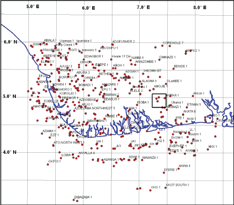
Table 1 Example of the temperature data set kindly availed by Department of Petroleum Resources, Nigeria; National Petroleum Corporation (the columns shaded in grey) and some products of data processing and supplementation. Location of the boreholes is shown in Figure 3.
Table 1:
| Name of operator | Oil Field | Well Name | Depth (TVD) (m) | Raw temperature°C | Corrected temperature°C | Offshore depth of water measured (m) | Coordinates measured from the DPR Nigerian Oil Block Map, 1969 | Geothermal gradient (°C/100m) | ||
|---|---|---|---|---|---|---|---|---|---|---|
| Longitude | Latitude | |||||||||
| 1 | SHELL | BONNY | OBEAJA 1 | 0 500 1000 1500 2000 2500 |
26 31.23 36.89 43.45 50.56 59.88 |
26.00 35.23 44.39 57.45 66.56 75.88 |
5.01 N | 7.21E | 2.00 | |
| 2 | SHELL | BONNY | OBUZO 1 | 0 500 1000 1500 2000 2500 |
26 32.23 35.89 42.45 51.56 58.68 |
26.00 36.23 43.39 53.45 65.56 74.68 |
4.58 N | 7.18E | 1.95 | |
| 3 | SHELL | BONNY | NGBOKO 3 | 0 500 1000 1500 2000 2500 |
26 31.77 36.32 43.56 50.66 59.23 |
26.0 35.77 43.82 54.56 64.66 75.23 |
4.55 N | 7.19E | 1.96 | |
| 4 | SHELL | BONNY | NKALI 03 | 0 500 1000 1500 2000 2500 |
26 32.33 35.59 42.65 51.66 57.78 |
26.00 36.33 43.09 53.65 65.66 73.78 |
4.60 N | 7.08E | 1.91 | |
| 5 | SHELL | BONNY | OLURE 2 | 0 500 1000 1500 2000 2500 |
26 33.66 38.44 43.81 52.22 60.44 |
26.00 37.66 45.94 54.81 66.22 76.44 |
4.57 N | 7.24E | 2.02 | |
The temperature data were subjected to corrections, analysis and interpretation.
The procedure adopted in the measurement of temperature in deep boreholes involves the use of the Schlumberger Auxiliary Measurement Sonde (AMS) with high sensitive sensor in the logging tool. The logging tool was lowered into the borehole and the temperature at various depth intervals determined in a process of continuous temperature logging.
The temperature was measured 8 hours after drilling when circulation of drilling fluid had stopped, so it was not enough of time for temperature in the hole to stabilize. During the drilling of wells, a substantial amount of drilling mud is circulated in the borehole to facilitate the drilling, evacuate the cuttings and stabilize the hole. Thus, the interaction of the mud, circulation and other drilling activities affects the thermal properties of the drilling fluid. Heat exchange between the hole and the mud, duration of drilling and non-equilibrium temperature at the time of measurements were reasons why collected temperature data had to be subjected to corrections before they were used for any meaningful research work. The short, 8 hours thermal recovery time is insufficient for full thermal recovery of the borehole making measured temperature to be lower than the true temperature of the rock formation. According to the experts from Department of Petroleum Resources in Lagos for full thermal recovery 72 hours of standing by time is needed. However, there are number research results presenting evidences that much more time is needed until the mud fluid in the borehole takes over the surrounding rock temperature. In case of temperature data subjected to some errors, they should be checked or compared to correct measurements taken when the hole temperature has reached equilibrium with the surrounding deep rock mass. In this study there was no any access to the thermal data from equilibrated wells which could let to calculate our own temperature correction factor for the Niger Delta, the empirically found correction factors from other sedimentary, oil bearing areas had to be used. The temperature correction for the borehole temperature data in this research work was carried out by using the American Association of Petroleum Geologist (AAPG) correction factor, which was previously tested for Nigerian sedimentary basins by other authors (Nwankwo and Ekine, 2009). The correction factors used in the study is presented in Table 2.
Table 2 Additions for correction of temperature records from non-equilibrated boreholes to true formation temperatures based on API method by American Association of Petroleum Geologist (AAPG), after Neglia (1979) and Nwankwo and Ekine (2009).
Table 2:
| Depth (m) | Added temperature quotient (°C) |
|---|---|
| 500 | 4.0 |
| 1000 | 7.5 |
| 1500 | 11.0 |
| 2000 | 14.0 |
| 2500 | 16.0 |
| 3000 | 17.5 |
| 3500 | 18.0 |
| 4000 | 18.0 |
| 4500 | 17.0 |
| 5000 | 15.0 |
Geothermal Energy Resources Calculation
When the natural conditions of the research area and the temperature at the depths were known, first geothermal gradients were calculated and map was produced (Fig. 5), then geothermal energy resources could be estimated. There were two approaches to the calculations (see the scheme in Fig.4), which were carried out with a use of Surfer and then the results were processed with GIS programs (Global Mapper, MapInfo) to produce digital maps. The first was an estimation of the accessible geothermal energy resources in a depth interval from ground surface to a depth of 4,000 m; the other map shown the total, static geothermal energy stored in sedimentary rocks of the basin (Fig. 6, 7). In both cases the geothermal resources were expressed as the amount of heat accumulated in rock mass per unit area. A calculation formula applied to program is shown below:
Q = Vs · ρs · cs · Ttrue – Tsurf/2A
where:
Q - geothermal energy (J/m2) resources in depth interval 0 – 4000 m or in the interval between the ground surface and the basement (0 – 6500 m),
Vs - volume of rocks (m3) from the ground surface down to 4,000 m depth or to the basement (0 – 6,500 m),
ρs - mean crustal density of rocks down to 6500 m depth (2600 kg/m3),
cs - mean specific heat of rocks down to 4000 m depth (840 J/kgoC),
Ttrue - temperature at 4000 m depth or at the top surface of crystalline basement (oC)
Tsurf - mean annual temperature at the Earth’s surface (27 oC)
A - area of calculation blocks (m2), (Muffler and Cataldi, 1977; Edwards et al, 1982; Górecki and Hajto, 2006).

The basic definition of geothermal energy resources presented in form of the equation above was proposed for the first time by Muffler and Cataldi, 1977. In the present work that equation was implemented to the Surfer program, to the calculating module. The processing of the equation in Surfer was based on some maps produced before: temperature at a depth of 4000m, basement depth map by Avbovbo [15] digitized before, map of temperature at the top of the basement (bottom surface of the sedimentary basin), map of the mean annual temperature of the air at the ground surface. All these maps were prepared in form of digital grids typical for all products of data processing in Surfer program [16-18]. Then, when the geothermal energy equation was introduced in the calculating window of the program, the particular constant values were assigned to the proper equation elements (density of rocks, specific heat, surface area) and to the other equation elements – variables, the whole digital grids were assigned (instead of single value used usually in manual calculations). The calculation results were obtained in a form of new output grid being a basis for interpolation and drawing the contours of geothermal resources on the new digital map [19,20]. In this way the evaluation of geothermal energy was carried out for the whole research area in one action of digital data processing oppositely to the conventional method of doing calculations for the particular points in the area.
Results and Discussions
The results of geothermal gradient calculation obtained from this study are in conformity with Nwachuckwus (1976) work on approximate geothermal gradient in Niger Delta sedimentary basin [21]. The gradients are lowest at the centre of the Delta and increase northward and southward. However, this study revealed some quite high values of the gradient in north-east. Generally, the values ranges from 1.5 °C/100m to 7.62 °C/100m [22-24]. Figure 5-7.

Figure 5: Geothermal gradient configuration map of the Niger Delta.

Figure 6: Geothermal energy resources map of Niger Delta Basin: Accessible resources down to 4000 m depth.

Figure 7: Geothermal energy resources map of Niger Delta Basin – total, static resources of the sedimentary rocks down to basement, a depth of 6.5 km.
Figure 6 shows the geothermal energy stored within the sedimentary rock mass down to a depth of 4000 m. It can be observed that the greatest accessible geothermal energy in this Basin is stored at the north-eastern to eastern parts of the Basin with values precisely greater than 1500 GJ/m2. This is a great and enormous geothermal energy potential that culd be utilised for electricity generation when the particular depth and sufficient amount and type of geothermal fluids are accessible [25-27]. Within the central parts of the Basin, geothermal energy lows of about 250GJ/m2 occur. The greater parts of the Basin, particularly the south to south-eastern and south-western areas offshore accumulated geothermal energy to the order of 1000 GJ/m2. This energy potential might also be utilised but it is offshore, far to the ocean, so it would be difficult to find some consumers of those energy [28]. The central part of the Basin possesses little geothermal energy as can be observed in Figures 6 and 7. It coincides with low geothermal gradients in the middle of Delta, which is explained by the thickest complex of the sediments (maximally even 12,000 m) and very rapid depositional processes and subsidence during evolution of that part of the area [29-31].
Conclusions
Three major geothermal anomalies were delineated and quantitatively interpreted as presented in form of maps showing the potential areas in both onshore and offshore parts of the Niger Delta. The constructed Niger Delta Maps of geothermal energy resources stored in the sedimentary rock mass for the accessible depth interval 0-4000 m shows two major onshore anomalies, one in the north (with maximum energy values, 800 GJ/m2), another in the east to northeastern part (maximum energy values 1250 – 1500 GJ/m2), and another two major anomalies located offshore, one in the south with values, 750-1000 GJ/m2, occurring at about 100 km seawards from the Eastern Obolo shores (Obianga Sheet), and the other, in the southwest offshore with values, 750-1250 GJ/m2, still at about 100 km from the shore. A second map of the Niger Delta showing geothermal energy resources stored in the sedimentary rock mass to depth from surface to basement is constructed. In this map, the sedimentary rock thickness is taken to depth of 6.5km. The map shows a small anomaly in the northern part with maximum value, 1500 GJ/m2 and a major anomaly occurring in the eastern part of the basin, with values 2000-3500 GJ/m2 onshore. Offshore in the south and southwest anomalies in the total sedimentary rock mass occur with highest values, up to 4000GJ/m2, with the southwestern anomaly extending west to the shore.
This geothermal study points out, that subsurface thermal properties of rocks and fluids can be applied not only in oil and gas industry as the indicators of hydrocarbon generation. Those parameters, together with geological and hydrogeological conditions can be consider as a factor in further research on possibility of geothermal energy utilisation. This energy use, instead of burning conventional energy sources, contributes to reduction of the volume of carbon dioxide released into the atmosphere, improves air quality. Its utilisation ultimately can contribute to reduction of global warming and its catastrophic consequences. When the geothermal conditions are appropriate and favorable, the use of geothermal energy could also trigger off a significant reduction of the use of firewood, charcoal, kerosene and would contribute to protection and restoration of the environment as the geothermal energy is environmentally friendly, clean and renewable. which would be particularly important for the degraded and extremely polluted Niger Delta Basin.
It is important to emphasize, however, that further research should be carried out aimed at hydrogeological conditions and geothermal modeling of the system. The simply temperature data set and general static geothermal resources evaluation is just a preliminary presentation of an idea about green energy utilization in the sticky, polluted and destroyed environment after, or even before the black liquid and blue gaseous treasures are exhausted completely and when thousands of abandoned oil/gas boreholes will be left for destruction.
Acknowledgements
The authors sincerely acknowledge Dr. Lambert Aikhionbare who linked us with the Department of Petroleum Resources, Lagos. We are extremely grateful to the Department of Petroleum Resources Lagos (NNPC) for making the temperature/depth data and Nigerias Oil Block Map available. Unalloyed thanks to Prof. S.B. Ojo and Dr. Adepelumi, both of the Geophysics Department, Obafemi Awolowo University, Ile-Ife who are respectively the Chairman and Member of the Geophysics Chair of Shell Petroleum Development Company at the University and other members who without them the geophysical data will not be available. Thank you all and God bless you.
References
- Reijers TJA (1966) Selected chapters on geology: sedimentary geology and sequence stratigraphy in Nigeria, three case studies and a field guide. Shell Petroleum Development Corporation. Corporate Reprographic Services. Warri
- Kurowska E, Schoeneich K (2010) Geothermal Exploration in Nigeria. Proceedings of World Geothermal Congress, 2010. Bali, Indonesia, 25-29 April 2010.
- Nwachukwu SO (1976) Approximate Geothermal Gradients in the Niger Delta Sedimentary Basins. The American Association of Petroleum Geology. Bulletin 60: 1073-1077.
- Avbovbo AA (1978) Geothermal gradients in the southern Nigerian basins. Bulletin of Canadian Petroleum Geology 26: 268-274.
- Avbovbo AA (1978) Tertiary lithostratigraphy of Niger Delta. American Association of Petroleum Geologist. Bulletin 62: 295-300.
- Onuoha KM, Ekine AS (1999) Subsurface temperature variation and heat flow in the Anambra Basin, Nigeria. Journal of Africal Earth Sciences 28: 641-652.
- Adedapo JO, Kurowska E, Scchoeneich K, Ikpokonte AE (2013) Geothermal gradient of the Niger Delta from recent studies. International Journal of Scientific and Engineering Research 4: 11.
- Akpabio I, Ejedawe J, Ebeniro J (2013) Thermal state of the Niger Delta Basin: Proceedings, Thirty-Eighth Workshop on Geothermal Reservoir Engineering. Stanford University, Stanford, California, February 11-13, 2013.
- Burke K (1972) Longshore drift, submarine canyons, and submarine fans in development of Niger Delta. American Association of Petroleum Geologists 56: 1975-1983.
- Whiteman A (1982) Nigeria: It’s Petroleum Geology, Resources and Potential. Graham and Trotman, London.
- Doust H, Omatsola E (1990) Niger Delta. In: Edwards, J.D., Santogrossi, P.A.(Eds), Divergent/Passive Margins Basins, Vol 4. American Association of Petroleum Geologists Memoir 4: 2239-248.
- Reyment RA (1965) Aspects of the Geology of Nigeria. University Press: Ibadan, Nigeria.
- Murat RC (1972) Stratigraphy and Palaeogeography of the Cretaceous and Lower Tertiary in Southern Nigeria. In: African Geology. Dessauvagie, F.J. and Whiteman, A.J. (eds). University of Ibadan Press: Ibadan, Nigeria, 251 – 266.
- Ekwueme BN, Nyong EE, Peters SW (1995) Geological excursion guidebook to Oban Massif, Calabar flank and Mamfe embayment, Southeastern Nigeria. 1st ed. Decford Publishers Ltd., 6-8.
- Avbovbo AA (1980) Basement geology in the sedimentary basins of Nigeria. Geology, vol. 8, pp 323-327.
- Abraham EM (2009) Spectral Analysis of Aeromagnetic data for geothermal energy investigation of Ikogosi warm spring. Ekiti state. Unpublished M.Sc Thesis submitted to department of physics, Ahmadu Bello University. Zaria. Nigeria.
- Akpabio IO (2009) Thermal Conductivity Estimates in the Niger Delta Using Lithological Data and Geophysical Well Logs. The Pacific Journal of Science and Technology 10: 1.
- Akpabio GT, George NJ, Udofia KM (2010) Determination of thermal and physical properties of sediments in Niger Delta using wire line log data: Archives of physics research 1: 48-55.
- Clauser C, Huenges E (1995) Thermal Conductivity of Rocks and Minerals. Rock Physics and Phase Relations: A Handbook of Physical Constants, American Geophysical Union Reference Shelf 3.
- Edwards LM, Chilinger GV, Ricke III HH, Fertl WH (1982) Handbook of Geothermal Energy. Gulf Publishing Company London, Paris, Tokyo.
- Górecki W, Hajto M (2006) Atlas zasobów geotermalnych na Nizu Polskim. Formacje mezozoiku. AGH GGiOS Kraków.
- Jubril MA, Shaw HF, Fallick AE (1998) Stable isotope and geochemical evidence of formation pore fluid evolution during diagenesis of Tertiary sandstones and mudstones of the Niger Delta. Journal of African Earth Sciences, Vol. 27, Nos 3 and 4, pp. 417-435, 1998, Elsevier Science Ltd.
- Kulke H (1995) Nigeria. In: Kulke, H. (Ed), Regional Petroleum Geology of the World, Part II: Africa, America, Australia and Antarctica. Gebru Borntraeger, Berlin, 143-172.
- Niger Delta Environmental Survey, NDES, 1997. Environmental and Socio-economic Characteristics. Phase.1 Report. Vol. 1.
- Nwazeagwu AU (1990) Hydrocarbon Exploration in Frontier Basin. The Nigeria Chad Basin Experience. Proceedings of the 26th Annual Conference of the Nigerian Mining and Geosciences Society. Port Harcourt.
- Oladipo AA, Oluyemi EA, Tubosun IA, Fasisi MK, Ibitoye FI, et al. (2005) Chemical Examination of Ikogosi Warm Spring in South Western Nigeria: Journal of Applied Sciences 5: 75-79.
- Robertson EC (1988) Thermal Properties of rocks. Department of Interior, USGS Open-File Report 88-441.
- Telford WM, Geldart LP, Sherff RE, Keys DA (1980) Applied Geophysics. Cambridge University Press Cambridge, 24-29.
- United Nations Development Programme, UNDP, (2010) Contribution of Energy Services to the Millennium Development Goals and to Poverty Alleviation in Latin America and the Caribbean, ECLAC Project Documents Collection.
- Weber KJ, Darkoru E (1971) Petroleum Geology of the Niger Delta. Geologie en mijnbouw 50: 559-576.
- Weber KJ, Daukoru EM (1975) Petroleum geology of the Niger Delta , In: Proceedings of the Ninth World Petroleum Congress, Geology. Vol 2. Applied Science Publishers Limited. London, 210-221.